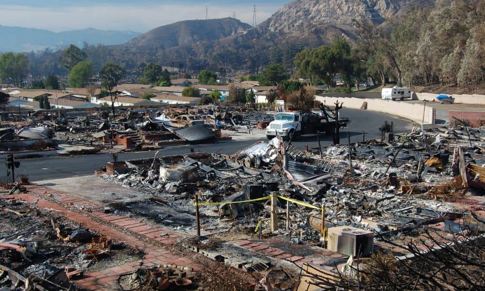
When wildfires sweep across Los Angeles, every second matters. We’ve seen this truth again in the last few days, as reports surfaced about evacuation delays during recent LA County fires. Some families waited longer than expected for alerts, while others struggled to understand if their homes were even in the official evacuation zone. The confusion didn’t just come from the smoke—it came from problems with maps, addresses, and access routes. That’s where a property survey can make the difference between risk and readiness.
Evacuation Delays Showed a Bigger Problem
Local officials admitted that evacuation alerts weren’t consistent across the county. In some hillside neighborhoods, streets weren’t labeled correctly in the system. In others, homes tucked behind gates or private drives didn’t line up with the county’s digital maps. The result? Firefighters and residents lost precious minutes trying to figure out who was at risk and how to reach them.
For homeowners, this is a scary reminder: if your property isn’t clearly mapped, it may not show up correctly when you need help most.
Why “Findability” Matters in Fire Season
Think about how many homes sit on winding canyon roads, behind tall gates, or along steep slopes. In the daytime, with no smoke, you can find them easily. But during a fire, when the air is dark and visibility is low, those same homes are much harder to spot.
If a firetruck can’t identify your driveway, if an evacuation team can’t confirm your address, or if a private road isn’t marked on official maps, delays are inevitable. That delay could be the difference between safety and loss.
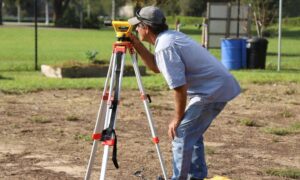
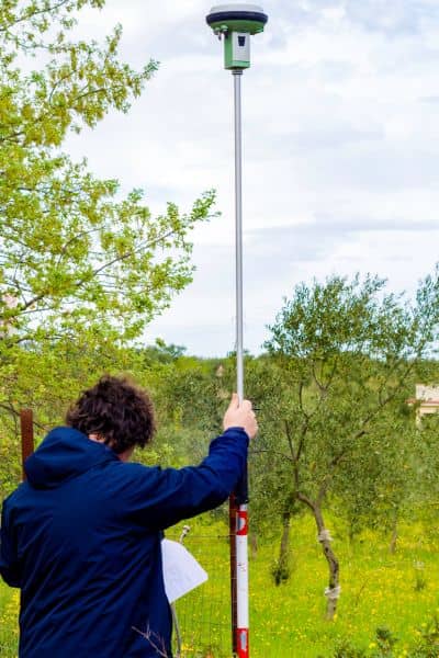
This is exactly where a property survey plays a life-saving role. A modern survey doesn’t just outline property boundaries—it can record access points, easements, and secondary routes. It creates a verified record that ties your home to the parcel and ensures that data matches up with official maps.
The Hidden Risks
Evacuation delays aren’t random. They often come from four hidden risks:
- Inconsistent or missing addresses. Some hillside homes don’t line up with parcel maps.
- Private roads without labels. Emergency maps often skip over unmarked access routes.
- Unmarked gates or driveways. Without visible signs, responders may waste time searching.
- No secondary exit. Many canyon or cul-de-sac homes only have one way in and out.
A property survey helps uncover these gaps. By documenting exact locations, driveways, and easements, surveyors create a clear record that can guide emergency teams in real time.
Tools You Can Use Right Now
Los Angeles County offers free resources that let you check your risk. The Fire Hazard Severity Zone maps and the new 2025 evacuation zone layers are available online. With a few clicks, you can type in your address, see your property on the map, and confirm if you fall into a high-risk area.
But here’s the catch: those maps are only as accurate as the data they rely on. If your property isn’t documented correctly, you might appear outside the evacuation zone even if you’re directly in harm’s way. Pairing those public maps with a verified property survey ensures you know exactly where you stand.
What Surveyors Look For in Wildfire Readiness
Surveyors are trained to see risks that most homeowners overlook. When preparing a property survey with wildfire safety in mind, they often check:
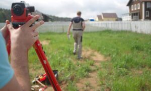
- Driveway slope and width. Can a firetruck make it up your driveway and turn around safely?
- Secondary access routes. If the main road is blocked, is there a legal easement that provides another way out?
- Defensible space. How close are structures to trees, brush, or slope edges?
- Address verification. Does the recorded parcel address match the one on the county’s maps?
Some surveyors even prepare a First-Responder Map—a simplified version of your property survey that highlights key access points and routes. Having this kind of document on file means emergency crews don’t waste time guessing.
Real-Life Scenarios That Hit Home
Let’s take three examples that residents can easily imagine:
- The hillside homeowner. Smoke fills a canyon and firefighters can’t spot the unmarked gate. Without a mapped driveway on record, the crew spends critical minutes searching.
- The new buyer. At closing, the property survey reveals that the only access road is private and unrecorded. During an evacuation, this could leave the home stranded.
- The custom builder. Before permits are issued, the fire department demands a turnaround spot for emergency vehicles. A surveyor’s measurements confirm the design meets safety standards.
Each of these situations proves one thing: property surveys aren’t just about paperwork—they’re about making sure your home is truly reachable.
Preparing Before the Next Fire Season
Too many homeowners wait until a crisis hits before thinking about their property’s safety. But surveys work best as a preventive measure, not as a reaction. If you live in a canyon, on a slope, or behind a gated road, ask yourself:
- Could first responders find me quickly in thick smoke?
- Do official maps show the right access to my home?
- Is there a backup route if my main driveway is blocked?
If you don’t know the answer, a property survey is the simplest way to find out.
A Small Step That Could Save Lives
Wildfires aren’t slowing down. Each season faces hotter, faster, and more unpredictable fires. Technology helps, but maps, alerts, and communication systems still depend on accurate property data.
By updating your property survey, you do more than protect your land rights—you protect your family and your community. When every second counts, clarity on a map can save a life.
So before fire season peaks, talk to a licensed surveyor. Ask for a First-Responder Map, check your access routes, and verify that your address lines up with official records. It’s a small step, but in Los Angeles, it may be the most important one you take this year.