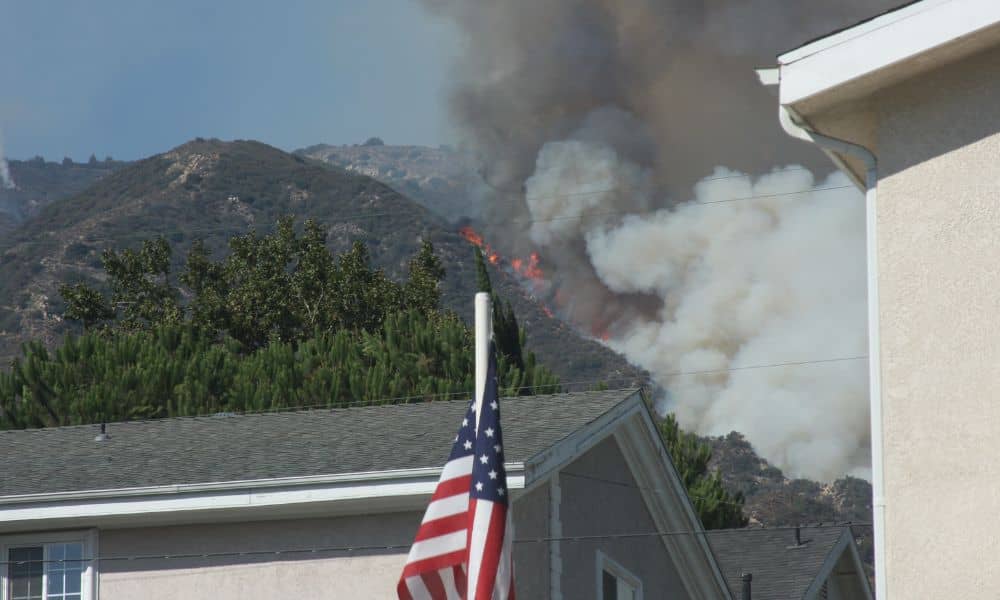
Days after the arrest linked to the deadly Pacific Palisades fire, Los Angeles is talking again about safety and rebuilding. Fires in hillside areas like the Palisades, Malibu, and Topanga leave behind more than ashes — they leave confusion over where one property ends and another begins. That’s where an ALTA Land Title Survey matters most. While news stories focus on the arrest and the investigation, thousands of homeowners face the next big step: rebuilding. And in LA, that starts with knowing exactly where your land begins and ends.
When News Turns Real
The Palisades fire filled every major headline — from LA Times to NBC Los Angeles. It reminded everyone how fragile hillside neighborhoods can be. Homes were destroyed, survey markers disappeared, and some streets now need new maps.
After a wildfire, even a few inches of lost ground markers can cause big issues. Some owners discover that fences, walls, or easements no longer match the legal lines on record. Before any rebuilding begins, planners and lenders want one thing: proof. That proof comes from a current ALTA Land Title Survey.
Why It Matters Now
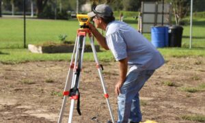
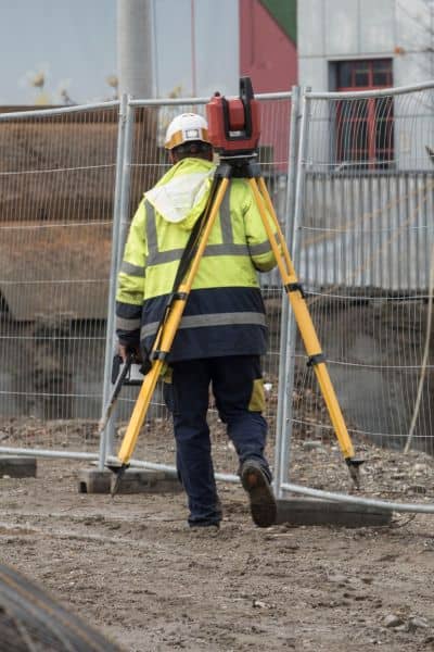
An ALTA Land Title Survey is not a basic boundary check. It’s the gold standard — trusted by lenders, title companies, architects, and insurers. It creates a detailed map showing boundaries, easements, rights-of-way, and improvements tied to your land.
After a fire, that map becomes priceless. Burned monuments and missing corner pins can turn a rebuild into a legal fight. A survey prevents disputes, keeps new construction within legal limits, and gives confidence to insurers and lenders.
In Los Angeles County, the Return & Rebuild program even advises homeowners to update surveys before applying for permits. In many cases, it’s not just smart — it’s required.
From Ashes to Accuracy
Imagine you’re ready to rebuild. Your contractor shows up with blueprints, but the foundation line doesn’t match what’s on your title. Without a verified ALTA Land Title Survey, no one knows which is right. That leads to delays, higher costs, and sometimes full redesigns.
Surveyors act like first responders for property data. They replace missing markers, locate encroachments, and confirm if your boundaries moved from erosion or debris removal. In hillside areas like the Palisades or Brentwood, small grade changes can shift walls, drainage, and setbacks.
Before plans reach the city, surveyors give architects, engineers, and lenders a clear picture they can trust. That step keeps your rebuild smooth and compliant.
How It Fits into LADBS Permits
The Los Angeles Department of Building and Safety (LADBS) has fast-track rebuild paths such as ED-1 and EO-1. They move projects faster — but only when all documents are complete. A recent ALTA Land Title Survey helps in several ways:
- Permits: Confirms site size for zoning and setback checks.
- Design: Gives architects accurate slope and boundary data.
- Financing: Lenders require a current survey before releasing funds.
- Title Protection: Title companies depend on ALTA data for coverage.
Skip the survey, and your entire rebuild could stall.
What Homeowners Are Saying
On Reddit’s LA boards, frustration is everywhere. One post reads, “I can’t start my ADU because my corner markers burned.” Others mention long waits for survey updates and confusion about overlapping lines.
These delays are real but avoidable. Getting your survey done early keeps inspectors, planners, and lenders on the same page. It’s the quiet step that helps your project stay ahead while others wait for approval.
Beyond Rebuilding: Protecting Your Title
Even if your home survived, the Palisades fire is a warning. Nearby owners now face refinancing, insurance checks, or new construction plans. An updated ALTA Land Title Survey protects you in each case.
Here’s how:
- Insurance: Proves your improvements match what’s on title.
- Refinancing: Gives lenders fresh data before they approve loans.
- Selling: Speeds closing by clearing up boundary questions.
A fire can destroy property. But an outdated survey can destroy a deal.
Local Terrain, Local Experts
Los Angeles isn’t flat. Hillside homes depend on slope and elevation data for safe design. After a fire, erosion and runoff can change that data overnight.
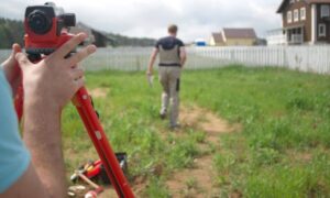
Local licensed surveyors use tools like GPS, laser scanners, and drones to rebuild lost information. Drone mapping captures burned terrain safely and quickly, giving engineers a clear site view before they enter it.
Combining drone images with ALTA standards ensures every detail is recorded — from easement widths to driveway grades. It’s not overkill; it’s smart rebuilding for today.
Get Started Early
You don’t need to be a survey expert. Before hiring a builder or filing permits, contact a licensed land surveyor who performs ALTA Land Title Surveys. Provide your deed, title commitment, and any past survey you have.
Good surveyors handle research, fieldwork, and coordination with your title or design team. They can also spot old or missing corner records before they become problems. Most clients get preliminary results within a few days — just enough to start planning confidently.
A Smart Step in a Hard Time
Rebuilding after a wildfire is emotional and exhausting. Doing it without accurate land data makes it worse. A precise ALTA Land Title Survey gives you and your lender proof that your land is legal, mapped, and ready to build.
Think of it as the foundation before the foundation. Once it’s done, everything else — permits, design, and financing — flows faster.
Los Angeles always rebuilds. If the Palisades fire taught us anything, it’s that recovery isn’t just about new walls — it’s about building on solid ground. And that solid ground starts with a surveyor’s line.