When the ground shakes or the street outside your home gives way, you don’t just worry about repairs. You also start thinking about property lines. A boundary line survey might not sound urgent until a quake cracks your driveway or a sinkhole swallows the curb. Yet in Los Angeles, these problems are more common than many homeowners realize.
In the past few days, a small earthquake near Pearblossom rattled northern LA County, while a major water-main break in Fullerton sent a geyser of water into the air before carving out a sinkhole that damaged cars and part of a neighborhood. Events like these may feel far away if they didn’t hit your street, but they show how fragile our infrastructure really is. And they highlight why property owners should care about accurate surveys, especially when the ground itself shifts.
Why Street Damage Creates Property Questions
Los Angeles is a city built on layers—fault lines, old pipes, and dense neighborhoods stacked together. When a quake or utility failure happens, the damage doesn’t stop at the street. Fences tilt. Retaining walls crack. Driveways settle unevenly. Suddenly, you can’t tell if your neighbor’s wall leans onto your yard, or if a collapsed curb pushes into your property line.
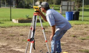
That’s where a boundary line survey matters. This type of survey marks exactly where your land begins and ends. After damage, it gives you proof of what’s yours—whether you’re filing an insurance claim, talking to city inspectors, or resolving a disagreement with the house next door.
Lessons from LA’s Recent Events
The Pearblossom quake was only a magnitude 3.3, but even small tremors can create shifts you don’t notice right away. Cracks in patios or tilting block walls may seem cosmetic at first. Months later, they can turn into costly disputes when someone insists the problem crosses the property line.
The Fullerton sinkhole told another story. When soil disappears beneath the street, nearby land can lose support. That means yards, fences, or even house corners may creep into uncertain territory. If you don’t know where your legal boundaries stand, repairs become complicated. Should you pay for rebuilding a fence, or does the city share responsibility? A survey is often the only way to settle that question with confidence.
How a Boundary Line Survey Helps After Damage
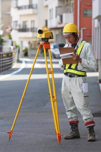
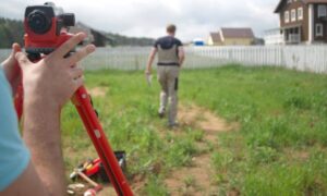
Think of a survey as your baseline. It captures the exact position of your property corners, lines, and any improvements near the edge. After a disruptive event, a surveyor can:
- Reestablish control points so you know if structures have shifted.
- Check vertical movement in slabs, garages, or driveways that meet public right-of-way.
- Document fence lines and retaining walls so disputes don’t rely on memory.
- Spot encroachments early, before they become lawsuits or permit issues.
Beyond protecting property rights, surveys help you move faster with repairs. When you know the legal boundaries, contractors can rebuild in the right place, avoiding delays with inspectors or neighbors.
What About Utilities and Hidden Risks?
Not all problems show up on the surface. Quakes and water-main breaks also disturb what’s underground. As-built utility maps are often outdated, and soil voids can form without warning. Modern surveyors can coordinate with specialists who use ground-penetrating radar, CCTV cameras, or even drones to map these hidden risks.
In Los Angeles, this matters because so many older neighborhoods sit on pipes installed decades ago. When they burst or shift, they don’t just cause flooding—they also affect grading, drainage, and property stability. A boundary line survey paired with utility checks provides a clearer picture of safety and liability.
Monitoring for Peace of Mind
For homeowners who live near fault lines or in areas with aging infrastructure, monitoring can be a smart step. Simple tools like tilt sensors on block walls or prism monitoring tied to survey equipment can detect movement before it becomes serious. If your fence starts leaning further into a neighbor’s yard, you’ll know quickly. And if things look risky, a geotechnical engineer can step in before repairs grow too expensive.
Protecting Your Rights and Your Wallet
Property disputes often start small. A cracked wall, a shifted curb, or a driveway patch that strays a few inches too far. Without documentation, arguments drag on. With a boundary survey, you hold a clear legal record. That record strengthens insurance claims, supports building permits, and helps you negotiate fairly if repairs overlap with neighbors or city property.
It’s not just about paperwork—it’s about peace of mind. In a city where earthquakes, sinkholes, and water breaks are part of life, proof of your property lines is as valuable as any insurance policy.
Local Action: Post-Event Boundary Check
For homeowners, now is the time to think ahead. After the Pearblossom quake and the Fullerton sinkhole, many families are asking new questions about safety and property limits. A quick Post-Event Boundary Check can answer them.
This check includes:
- Spot levels at your garage and driveway.
- Fence line lean measurements.
- Corner verification against city benchmarks.
- Documentation you can keep for insurance or permits.
It’s a small step that can save you thousands in the future—and it brings clarity during times when the ground feels anything but stable.
Final Thoughts
Los Angeles will keep shaking, and our streets will keep aging. We can’t control when the next water-main breaks or where the next tremor hits. What we can control is how prepared we are. A boundary line survey is one of the simplest, smartest ways to protect your home and your rights.
Recent events are a reminder: when the ground moves, the lines between neighbors, streets, and properties get blurry. Don’t wait for damage to decide who owns what. Mark your boundaries now, so you’re ready for whatever comes next.