Los Angeles is famous for its rolling hills, canyons, and beautiful hillside homes. But when wildfire season hits—and heavy rain follows—those same hills can quickly become dangerous. Mudslides, slope failures, and debris flows can strike without warning. That’s why drone surveying has become one of the most useful tools for homeowners, builders, and engineers in the city’s wildfire-prone areas.
When Nature Shifts, So Does the Land
After a wildfire, the ground becomes weak. Burned plants no longer hold the soil together, so when it rains, the dirt can slide downhill. This isn’t just a problem in the mountains—it also affects homes, driveways, and walls all over Los Angeles County.
In October 2025, a rare storm dropped several inches of rain over the Palisades and Topanga. Within hours, slopes gave way, drainage channels filled with mud, and streets flooded. Homeowners began asking one question: Is my property still safe?
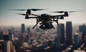
That’s where drone surveying comes in. Unlike old methods that take days or require people to climb unstable slopes, drones can scan large areas in minutes. They show exactly where the ground has moved, where drainage has changed, and where the next problem might happen.
Why Drone Surveying Is So Important
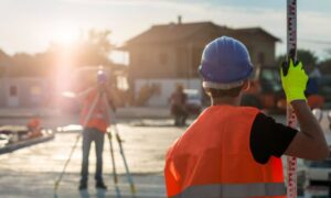
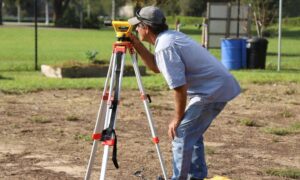
A drone survey isn’t just an aerial picture. It’s a detailed 3D map of the land. Using cameras, sensors, and LiDAR technology, drones capture every curve and slope on your property.
Surveyors then turn this data into accurate elevation models and contour maps. Engineers use these maps to check slope angles, drainage paths, and signs of erosion. Most importantly, this information helps property owners make smart decisions before a small issue becomes a major slide.
Drone surveying also keeps people safe. Instead of walking on dangerous hillsides, surveyors can map everything from the sky. Drones can spot blocked drains, damaged walls, and soil cracks that might not be visible from the ground.
Connecting Drone Surveys With Local Mapping Tools
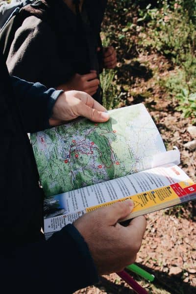
Los Angeles has public map systems like ZIMAS (Zoning Information and Map Access System) and the Record of Survey (ROS). When combined with drone data, these tools give property owners and contractors a complete view of their site.
Here’s how they work together:
- ZIMAS shows whether your property is in a Landslide, Liquefaction, or Very High Fire Hazard Severity Zone (VHFHZ).
- The Record of Survey confirms your property’s boundaries, corners, and elevation points.
- Drone surveying adds fresh data on the slope, elevation, and drainage conditions.
By using these tools before starting a project, you can spot risks early. For example, a home remodel in the Hollywood Hills might pass zoning checks but fail inspection if a drone survey later shows unstable slopes or poor drainage.
Why It Matters After Heavy Rain
After strong storms, drone surveys help detect small land movements before they become dangerous. Engineers can compare the new terrain data with older maps and see where the slope has changed.
This is very useful for:
- Insurance claims: Clear aerial evidence helps prove damage.
- Permit updates: LADBS (Los Angeles Department of Building and Safety) often requires updated topographic data after big storms.
- Emergency repairs: Drone data helps crews see which slopes or retaining walls need urgent work.
Even a few inches of soil shift can change where rainwater flows. That can decide whether water drains into the street or toward your home’s foundation.
Smarter Planning for Hillside Projects
If you plan to build or remodel on a hillside lot, drone surveying can save time and money. Before construction, a surveyor can scan your land to capture the exact slope, grade, and existing walls.
Engineers then use that data to design safer foundations, stable slopes, and better drainage systems. It also helps you avoid problems later, like finding out your wall crosses a property line or your driveway doesn’t drain properly.
Submitting drone-based maps can also speed up permits. LADBS reviewers often prefer current topographic data, especially for hillside or fire-risk zones. Clear drone maps help reduce back-and-forth corrections that delay approvals.
Real Stories From Los Angeles
1. Pacific Palisades After a Wildfire. After a fire, homeowners used drone surveys to check which burned areas might erode. The maps helped engineers design new drainage and get quick permits for slope repairs.
2. Hollywood Hills Remodel. Drone maps revealed hidden drains and old walls buried under new landscaping. That saved the contractor from unexpected delays during excavation.
3. Malibu Driveway Washout. A homeowner’s driveway collapsed after heavy rain. Drone mapping provided detailed elevation data, helping engineers rebuild with better stormwater control.
These stories show how drone surveying helps both large projects and regular homeowners all over Los Angeles.
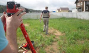
What Happens During a Drone Survey
First, the surveyor reviews your property using ZIMAS and ROS to identify hazards or flight restrictions. Then, the drone captures hundreds of high-quality images or LiDAR points.
Within one or two days, you’ll get:
- A topographic map that shows the land’s elevation and slope.
- A 3D terrain model to visualize your property.
- Optional aerial photos for reports and design work.
You can share these files with your engineer or submit them directly for permits.
A Safer, Faster Way to Protect Your Property
Drone surveying has changed how Los Angeles handles its hillside challenges. Whether checking damage after a storm or preparing for a remodel, it gives clear, reliable information—quickly and safely.
And while the technology sounds advanced, the goal is simple: to keep people and property safe.
If your property sits near a hillside, canyon, or wildfire area, don’t wait for the next storm. A short drone survey can reveal hidden risks and help you plan repairs before serious damage happens.
Final Thought
Los Angeles will always face wildfires and heavy rains, but smart planning makes all the difference. Drone surveying gives homeowners and builders the power to prepare, prevent, and protect—keeping hillside living safe and sustainable for years to come.