If you plan to build, remodel, or redevelop property, paperwork can stop you before work even starts. Many projects stall during plan check, not because of bad design, but because of missing or unclear land data. An alta title survey helps fix that problem early. When done right, it gives permit reviewers clear proof of what exists on the ground and what the law allows. As a result, projects move forward with fewer delays and fewer expensive resubmissions.
Los Angeles has a strict review process. Because of that, small mistakes can turn into big setbacks. However, the right survey keeps everyone aligned from day one.
Why permit reviews fail before construction begins
In Los Angeles, permit reviews often fail long before inspectors visit a site. Plan checkers look closely at documents to confirm that every drawing matches legal records. If something does not line up, they pause the review.
This happens often. For example, a site plan might show a driveway that crosses an easement. Or the building footprint might sit too close to a property line. These issues do not come from poor design. Instead, they come from unclear or outdated land information.
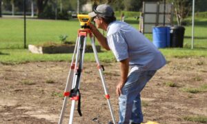
An alta title survey reduces these risks. It brings together boundary data, title records, and visible site features in one certified map. Because of that, reviewers can verify details faster and with more confidence.
How plan reviewers use an ALTA title survey
Permit reviewers treat surveys as verification tools. They do not use them as suggestions. During plan check, they compare the survey to architectural and engineering drawings.
They focus on a few key points:
- Do the lot lines match the site plan?
- Does the project respect recorded easements?
- Is there legal access to the property?
- Do improvements sit within allowed limits?
When answers appear clear, the review continues. When answers raise doubts, the review stops. In many cases, reviewers rely on the ALTA title survey as the final word. That trust speeds decisions and avoids back-and-forth comments.
Agencies like the Los Angeles Department of Building and Safety expect consistency. When drawings and surveys agree, approvals move faster.
Common survey issues that trigger rejections

Permit rejections often trace back to the same survey problems. Knowing them helps you avoid delays.
First, boundary dimensions sometimes fail to match architectural drawings. Even a small mismatch can raise red flags. Next, easements may appear on title records but not on site plans. Reviewers notice these gaps right away.
Another issue involves scale. If property lines stretch or shrink between documents, reviewers question accuracy. Also, some surveys miss certifications needed for lender or title coordination. That omission can pause both permits and financing.
Finally, many surveys serve closing needs only. While that helps a sale, it does not always support permitting. A survey prepared for permit review must align with design work, not just title insurance.
Why survey age matters during permit review
Survey age plays a bigger role than many people expect. Los Angeles reviewers often question surveys older than six to twelve months. Even without disasters or law changes, sites evolve.
Nearby construction can shift access points. Utility work can add new easements. Parcel records can update. When surveys fail to reflect current conditions, reviewers hesitate.
An updated alta title survey shows that the project team works with fresh data. It also reduces the chance that reviewers request revisions later. While updates add cost upfront, they save time and money during review.
Coordination problems that slow approvals
Permits rarely fail because of one mistake. More often, coordination breaks down between teams. Architects may design from old survey files. Engineers may redraw boundaries by hand. Title commitments may change without updates to the survey. When that happens, documents stop matching.
ALTA title surveys should serve as the shared reference. When surveyors stay involved through design and review, teams fix issues early. That approach keeps plans consistent and reviewers confident.
How corrected surveys speed up resubmittals
Sometimes rejections still happen. When they do, a corrected survey often clears comments faster than revised drawings alone.
Why? Reviewers trust certified land data. When a surveyor updates boundaries, easements, or notes, the fix carries authority. In contrast, patched drawings raise more questions.
Because of this, many successful teams correct the survey first. Then they update plans to match it. This order shortens resubmittal cycles and limits repeat comments.
When to order an ALTA title survey
Timing matters. Ordering an ALTA title survey too late leads to redesigns and delays. Ordering it early sets a strong base.
The best times include:
- Before site feasibility studies
- Before architectural design begins
- Before plan check submission
- Before lenders issue final conditions
Early surveys help teams design within real limits. They also reduce surprises during review.
Questions clients should ask before hiring a surveyor
Clients do not need technical knowledge to make smart choices. A few clear questions help a lot.
Ask if the survey supports permit review, not just closing. Ask if the surveyor coordinates with architects and engineers. Also ask how updates work if comments come back.
Clear answers show experience with permits. They also show commitment to keeping projects moving.
Final thoughts:
Most permit delays start on paper, not on the site. In Los Angeles, reviewers demand clear proof before approval. An alta title survey provides that proof when done right.
It aligns teams, reduces questions, and prevents costly resubmissions. While it may feel like one more step, it often becomes the step that saves the most time.
When land data stays clear, permits move forward. And when permits move forward, projects finally begin.