Welcome to ALTA Survey Los Angeles

Your Final Stop for Your ALTA Survey Needs!                              Contact us today for a free quote!

This site is intended to provide you with information on ALTA Surveying in Los Angeles. If you’re looking for a Los Angeles Land Surveyor, you’ve come to the right place. If you’d rather talk to someone about your land surveying needs, please call our toll-free number at (888) 808-9783 today. For more information, please continue to read.

ALTA Survey Los Angeles

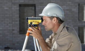
Land Surveyors are professionals who make precise measurements to determine the size and boundaries of a piece of real estate.  While this is a simplistic definition, boundary surveying is one of the most common types of surveying related to home and land owners. If you fall into the following categories, please click on the appropriate link for more information on that subject:

ALTA Survey Los Angeles services:

    1. I need to know where my property corners or property lines are. (Boundary Survey)
    2. I have a loan closing or re-finance coming up on my commercial property. (ALTA Survey)
    3. I need a map of my property with contour lines to show elevation differences for my architect or engineer. (Topo Survey – ALTA Survey plus Table A Item 5.)
    4. I’ve just been told I’m in a flood zone or I’ve been told I need an elevation certificate in order to obtain flood insurance or prove I don’t need it. (Flood Survey)
    5. I’m purchasing a lot/property for a commercial use. (ALTA Survey – Item 5 and/or Item 11b may also need to be discussed.)
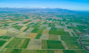
    6. I’m purchasing a larger tract of land, acreage, that hasn’t been subdivided in the past. (Boundary Survey)

More Posts

An ALTA title survey being reviewed alongside site plans to confirm property boundaries and easements during permit review
alta survey
Surveyor

How an ALTA Title Survey Prevents Costly Permit Rejections

If you plan to build, remodel, or redevelop property, paperwork can stop you before work even starts. Many projects stall during plan check, not because of bad design, but because of missing or unclear land data. An alta title survey helps fix that problem early. When done right, it gives

Read More »
Homebuyers signing paperwork with an agent during a loan closing survey review
alta survey
Surveyor

Loan Closing Survey: What Your Lender Won’t Tell You

If you’re buying a home or refinancing the one you already have, your lender might suddenly say, “We need a loan closing survey.” You hear that and think, Okay… what does that even mean? Then the clock starts ticking. Escrow wants dates. Your rate lock has a deadline. Meanwhile, nobody

Read More »
A surveyor using a tripod and total station to perform a construction survey on a building site
land surveying
Surveyor

Why Skipping a Construction Survey Can Cost Thousands

Los Angeles is known for fast growth, busy job sites, and constant building activity. But right now, something different is happening. A new forecast shows that many developers across California are delaying or slowing down their projects. Because of higher costs, supply chain issues, and market uncertainty, more than one-third

Read More »
Aerial surveying view showing large land parcels and terrain patterns from above
land surveying
Surveyor

The Future of Land Records Starts With Aerial Surveying

Land records shape everything in a city. They show who owns what, where people can build, and how much a property is worth. They also affect how fast a project gets approved. Today, many places still use old paper maps and outdated drawings. Because of this, mistakes happen. Lines move.

Read More »
Aerial view of hillside homes where elevation surveys help show how changing flood zones and land movement affect each property
flood damage
Surveyor

Do New Flood Maps Mean You Need Elevation Surveys Now?

Los Angeles homeowners are paying close attention to elevation surveys right now, and for good reason. New local flood-zone updates are rolling out, and many people are finding out their home may sit closer to risk than they once thought. With recent storms, hillside shifts, and fresh reports about land

Read More »
Digital HUD view showing how a robotaxi scans the road ahead using lidar mapping to understand street details in real time
flood damage
Surveyor

Why Is Lidar Mapping Becoming Key for Robotaxis?

Los Angeles changes fast. New bike lanes appear overnight, construction zones shift every week, and traffic never stays the same for long. While most people only notice these changes when they’re stuck in traffic, something else is happening quietly on the streets every single day. Robotaxis are driving around the

Read More »