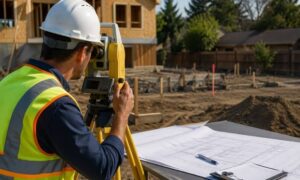
If you’re planning an SB 9 lot split, the first thing you need is a clear picture of your land. And that starts with a topo survey, the map that shows your property’s true shape, slopes, and layout. Many homeowners think they can begin designing right away, but SB 9 works very differently. Before the city reviews your plans, your architect draws a layout, or you decide where new homes will go, the topo survey sets the rules. Without it, your SB 9 project slows down fast.
SB 9 offers an exciting chance to turn one lot into two legal lots, and possibly add up to four homes. Because of that, many owners move quickly, hoping to build rentals for extra income or create housing for families. Yet Los Angeles has strict rules you must satisfy before the split becomes real. The topo survey is the document that shows if your land can even support the plan you have in mind.
The Topo Survey Is Step One for Any SB 9 Plan
SB 9 sounds simple on paper. You divide your lot, turn it into two parcels, then build. But the city wants proof that each new lot will work on its own. That means each one needs safe access, space to fit a home, and room for utilities. A topo survey gives the data needed to test all those things.
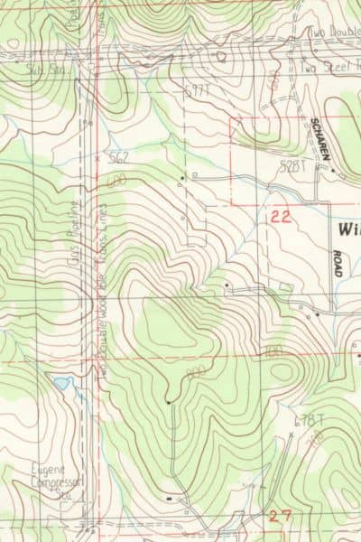
Unlike a quick sketch or a basic plot map, a topo survey shows actual elevations, slopes, and features across your property. It reveals how steep the land is, how water flows, and where structures sit. It also shows where the ground rises, dips, or twists in ways your eyes can’t catch. For SB 9, this matters. A gentle slope can support a driveway. A sharp slope can stop the project. You won’t know until the topo is done.
Why SB 9 Needs a More Detailed Survey Than a Regular Project
A standard remodel may only need a simple site plan. SB 9 involves a legal lot split, which makes the city’s review much stricter. Each new lot must meet size and ratio rules. Both lots must allow safe access for future homes. And both must handle utility lines without major changes.
Because of that, the topo survey must include information far beyond basic elevation lines. Los Angeles wants a map that shows everything that affects the split, including:
- Precise boundary lines
- Contours across the whole site
- Driveway slopes and access routes
- Retaining walls and grade breaks
- Utility locations and easement areas
- Structures that might block future building pads
While this may seem like a lot, it helps prevent problems later. Many SB 9 plans fail for reasons that only show up once the land is mapped correctly. With a proper topo survey, you avoid redraw after redraw.
The Survey Shapes the Parcel Map
Every SB 9 project requires a parcel map, which is the legal document that creates the new lots. Your engineer uses the topo survey to draft that parcel map. Without the topo, the parcel map can’t begin. This step alone explains why so many SB 9 projects stall. People try to design buildings or talk to architects before the land is measured. Then they find out the city won’t review anything without accurate topographic work.
The parcel map also goes through layers of review. Los Angeles City Planning, Public Works, and the Bureau of Engineering all look at it. They check access slopes, fire reach, lot width, setbacks, and clearances. If any portion is wrong because the topo survey was incomplete, the city returns it with corrections. This can add weeks or even months to your timeline.
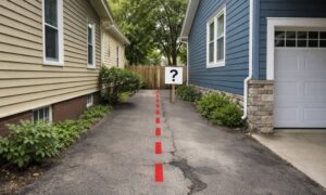
What Happens When the Topo Survey Arrives Late
When homeowners delay the topo survey, they delay everything else. Architects draw plans that don’t match the real ground. Driveway slopes turn out to be too steep. Setbacks change once true boundaries are known. Or a future house ends up sitting on a grade that requires a huge retaining wall.
Here are problems that show up often:
Access Fails. Sometimes a driveway looks fine until the topo survey shows a 20% slope. Fire rules limit driveway slopes in many areas, especially hillside neighborhoods. If access fails, the split fails.
Utility Lines Conflict. Your topo survey may show sewer or water lines running through the part of the lot you planned to use for a driveway or building pad. Utility relocations cost a lot and may not be allowed.
Lot Sizes Don’t Meet City Rules. SB 9 requires each new lot to meet minimum size ratios. A boundary line that looked correct on paper may not satisfy the rule when measured through a topo survey.
Existing Structures Get in the Way. Sheds, garages, and even main homes sometimes sit in locations that block the only workable split line. You won’t know until the land is measured.
In each situation, the topo survey reveals the truth. And the truth may require redesigns or a new layout. Early data saves time, money, and frustration.
SB 9 Survey Costs: What Homeowners Should Expect
Because SB 9 involves more detail, the topo survey usually costs more than a standard single-family survey. Across Los Angeles, you can expect:
- Topo + boundary survey: $5,000–$10,000
- Parcel map preparation: $8,000–$20,000
These prices vary based on slope, lot size, easements, and research time. Steep lots in areas like Mount Washington or Silver Lake usually cost more because the work takes longer and the data is more complex.
Even though this is a real investment, it helps you avoid larger costs later. Redesigns, engineering changes, and city corrections often cost more than the survey itself.
When to Order Your Topo Survey
The best time to order your topo survey is before you speak to an architect, engineer, or designer. You also want it before submitting anything to the city. Once you have the topo, everyone involved can design and plan based on facts instead of guesses.
This gives you a smoother SB 9 process because:
- You avoid false starts
- You avoid large redesign fees
- The city gets clean data on the first review
- You save weeks of back-and-forth with reviewers
Good projects start with good information. The topo survey is that information.
The Bottom Line
Your SB 9 project depends on the topo survey. It shapes your design, your parcel map, and your approval timeline. When you begin with clear land data, you avoid delays, surprises, and expensive mistakes. And since SB 9 can add real value to your property, starting with the right survey helps you move forward with confidence.
If you’re ready to explore an SB 9 lot split, begin with the topo survey. It’s the smartest way to make sure your plan is possible, buildable, and ready for approval.