How AI Is Changing Land Surveying Today
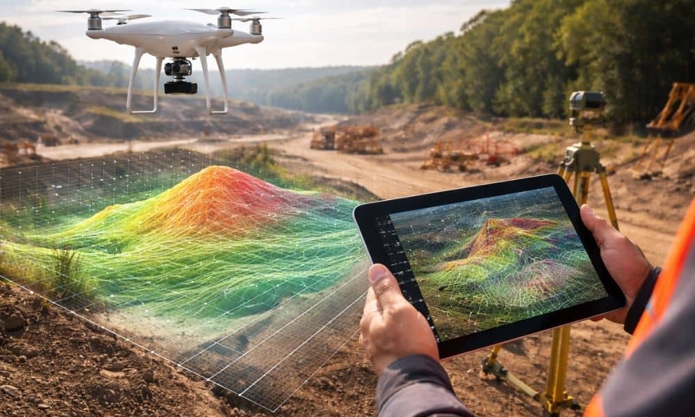
Many people still picture land surveying the same old way. They imagine a surveyor with a tripod, standing in the field all day. That still happens. However, the tools behind modern land surveying have changed very fast. Today, surveyors also use AI-assisted software, LiDAR scanners, and drone mapping to collect and study land data. These […]
How a Licensed Land Surveyor Evaluates Your Property
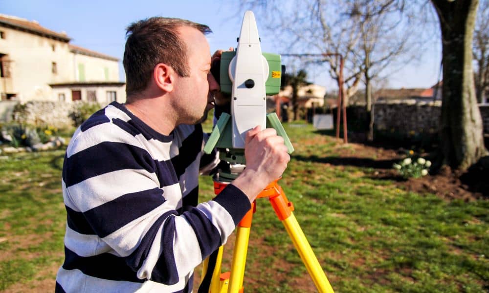
If you have ever contacted more than one survey company and received very different price quotes, you are not alone. Many homeowners and buyers feel confused when one licensed land surveyor charges much more or less than another. At first, this can feel frustrating. Still, there is a lot happening before a quote is ever […]
Why a Due Diligence Survey Matters After a Wildfire
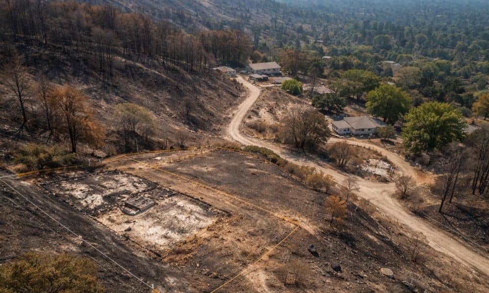
Wildfires change more than homes and trees. They change land. Across Southern California, recent fires have left behind burned slopes, damaged access roads, and cleared parcels that look simple at first glance. However, what looks “clean” after a fire often hides new risks. Because of this, a due diligence survey matters more now than it […]