
Why Land Survey Delays Slow Down Your Rebuild
Rebuilding is moving quickly across Los Angeles right now. Many property owners are ready to start over, fix damage, or build something new. At the

Boundary Line Survey for Property Line Disputes
It usually begins with something small. A neighbor walks over and says, “I think part of your yard is actually mine.” At first, it sounds

ALTA Survey: Why Insurance Rebuilds Now Require One
Rebuilding a home in Los Angeles after a disaster can feel hard. Fires, storms, and other events can damage homes and land. Because of this,
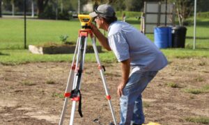
Why Hiring a Licensed Land Surveyor Protects Your Property
Owning property in Los Angeles often means making plans. Many homeowners want to build something new. Some plan to add a fence. Others want to

Can an Elevation Certificate Lower Your Flood Insurance?
Buying a home in Los Angeles feels exciting—until a lender tells you the property sits in a flood zone. Suddenly, you must carry flood insurance.

How Public Drone Growth Impacts Drone Land Surveying
Los Angeles has always moved fast. Now, the skies above the city move fast too. In 2026, public agencies across Los Angeles continue to expand