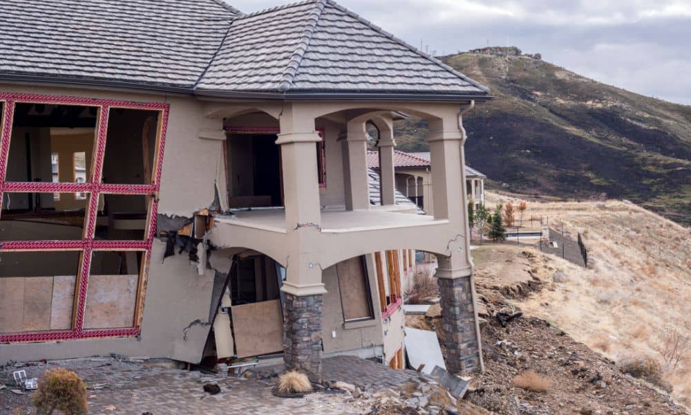
When the Rancho Palos Verdes bluff collapsed last week, neighbors watched their backyards slide into the ocean. Streets closed, homes were yellow-tagged, and families wondered what this meant for their property. In moments like this, one tool becomes critical: the boundary survey. It’s the way homeowners can confirm where their land begins and ends—even when the ground itself has shifted.
Los Angeles is no stranger to natural hazards. Fires, earthquakes, and heavy rains all reshape the landscape in sudden, painful ways. But landslides bring a special kind of confusion. You can see that your lot looks different, but your deed doesn’t explain where the new cliff edge falls. That’s where surveyors step in with both science and clarity.
Why Boundaries Still Matter When Land Moves
Imagine standing at the edge of your property after a slide. The fence posts are gone, the retaining wall disappeared, and part of the hillside now sits at the bottom of a canyon. Does your legal property line move too? The short answer is no. Deeds, plats, and recorded maps don’t shift with the soil. But proving those lines requires fresh evidence, and that’s exactly what a boundary survey delivers.
Surveyors rebuild the story of your property using reference points that survived the slide. They tie measurements back to benchmarks set in stable ground. They replace missing markers with temporary ones, then prepare legal maps that restore clarity to ownership records. Without this work, neighbors, insurance companies, and even city officials may argue over where one lot stops and another begins.
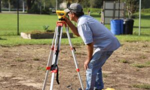
What a Post-Slide Boundary Survey Looks Like
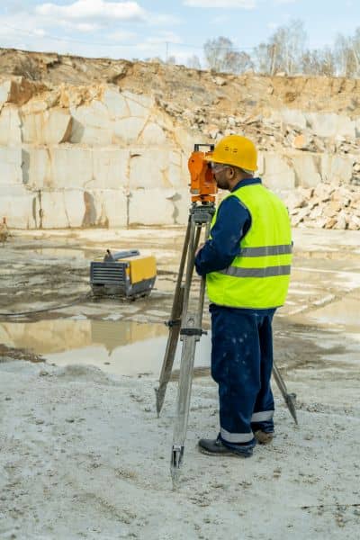
A boundary survey after a landslide is not a simple walk with measuring tape. Surveyors bring high-precision equipment like GNSS receivers, robotic total stations, and sometimes drones with lidar sensors. These tools create a new map of the site, one that shows the changed topography while still connecting back to legal descriptions on record.
For a homeowner, that means the survey will:
- Identify the new edge of stable ground.
- Locate or replace property corners that vanished.
- Establish a reliable control network tied to county benchmarks.
- Document the difference between what existed before and what remains now.
The result is more than a set of measurements. It’s professional land boundary mapping that turns shifting ground into a clear picture of your property—evidence you can rely on when insurers, lenders, or the city start asking questions.
Why Time Matters After a Landslide
Within 48 to 72 hours of a slide, property owners often face urgent requests. Insurance adjusters want proof of boundary locations to process claims. Homeowners’ associations may ask for sketches to decide on shared slope repairs. City officials may require maps before issuing any rebuilding permits. Without a boundary survey, you risk delays, disputes, or even denied claims.
Quick action also protects you from future headaches. If boundaries aren’t documented soon after the event, neighbors may claim land that was never theirs. Or, worse, repairs might happen on the wrong side of a line, leading to legal fights later. Acting fast keeps control in your hands.
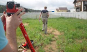
Watching the Ground Over Time
Landslides rarely stop with one dramatic movement. Hillsides often continue shifting for weeks or months, especially after heavy rains. Surveyors call this deformation monitoring. It’s a process of measuring small but steady changes to see if the ground is stabilizing or still creeping downhill.
Monitoring involves setting targets on the slope and checking them at regular intervals. Total stations can measure movement to a fraction of an inch. GNSS receivers capture changes across wider areas. Drones or lidar scans provide visual proof of cracks or slumping. For homeowners, this means you’ll know if it’s safe to rebuild—or if patience is the smarter choice.
The Legal Weight of Survey Records
One of the most important outcomes of a boundary survey is the official paperwork. In Los Angeles County, surveyors may file either a Corner Record or a Record of Survey. These filings serve as public proof of where your property lies. They are the documents that courts, lenders, and title companies respect.
If markers are destroyed, surveyors prepare Corner Records to show how they replaced them. If the slide created larger discrepancies, a full Record of Survey may be required. Both documents protect your ownership rights by showing that boundaries are tied to evidence, not guesswork.
How This Impacts Real People
Consider a family living on the bluffs of Malibu. After a winter storm, part of their yard collapsed. Their neighbor quickly put up a new fence—several feet closer to their home. Without a survey, the family had no way to prove the fence was misplaced. With a boundary survey, they could show exactly where the property line belonged and force the correction before permanent structures went up.
Or picture a small HOA in Palos Verdes. A slide pushed soil into the shared road. Some members wanted to split the cost evenly, while others argued the slide only affected certain lots. The only fair solution came from a survey that mapped the original lot lines against the new ground surface. With evidence in hand, the HOA could make decisions without years of arguments.
Where Homeowners Can Turn
Los Angeles County makes resources available online. You can look up Records of Survey, check corner records, and even search for benchmarks near your property. But navigating these tools on your own is difficult. Partnering with a licensed land surveyor brings clarity and expertise. They know how to translate legal descriptions, file paperwork correctly, and create evidence that holds up under scrutiny.
For homeowners, the takeaway is simple: don’t wait for disputes to arise. If you live on or near a bluff, hillside, or canyon, consider asking a surveyor for a baseline boundary survey even before trouble strikes. That way, if the ground moves, you’ll have a reference to compare against.
Closing Thoughts
Landslides will always be part of life. From Palos Verdes to Malibu, steep slopes and winter rains create risks that can’t be ignored. But property rights don’t vanish with the soil. They remain, and it’s up to you to protect them with clear evidence.
A boundary survey gives you that protection. It defines where your land begins and ends, even when nature redraws the landscape. It supports insurance claims, speeds up rebuilding, and stops disputes before they escalate. Most of all, it gives you peace of mind in a time of stress.
So if you live on a hillside or bluff, don’t wait for the next storm. Talk to a licensed land surveyor about documenting your property now. Because when the ground moves, your deed doesn’t change—but your evidence must.