Wildfires change more than homes and trees. They change land. Across Southern California, recent fires have left behind burned slopes, damaged access roads, and cleared parcels that look simple at first glance. However, what looks “clean” after a fire often hides new risks. Because of this, a due diligence survey matters more now than it did before.
Buyers, developers, and lenders are moving quickly to rebuild. At the same time, cities are tightening reviews. As a result, relying on old plats or assumptions can lead to costly mistakes. A due diligence survey helps confirm what is really there today, not what existed years ago.
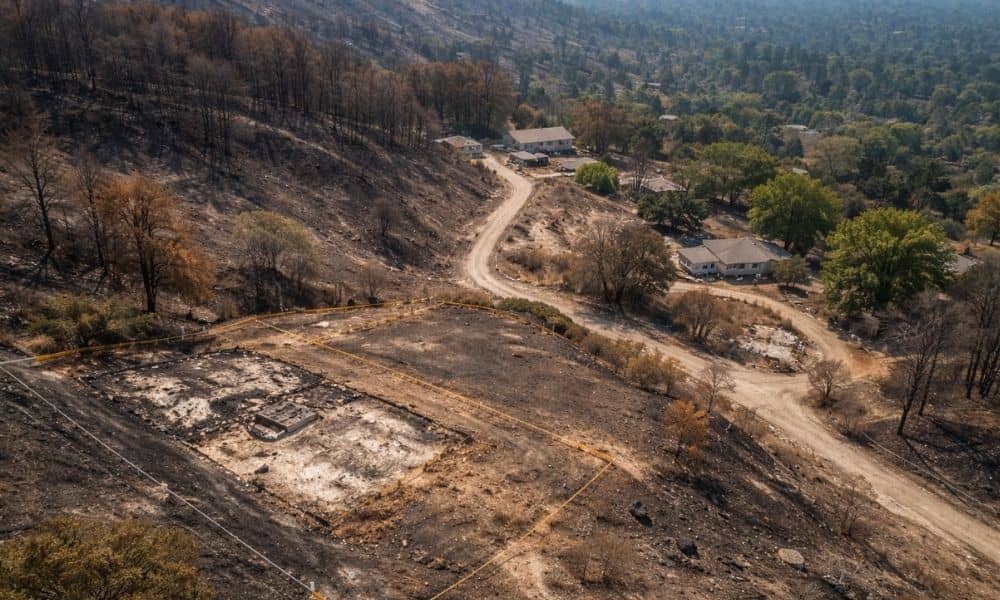
Wildfires Change the Ground, Not Just the View
After a wildfire, land can look open and ready. Still, fire alters how property works. Markers burn. Soil shifts. Drainage paths change. Even access points used during fire response may block recorded easements later.
Because of this, paper records often fall out of sync with real conditions. A due diligence survey closes that gap. It checks the land as it exists now. That step helps buyers avoid surprises once cleanup or construction begins.
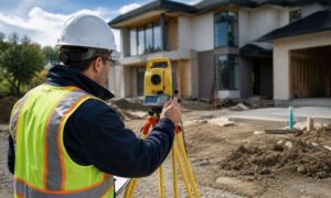
What a Due Diligence Survey Really Does
A due diligence survey is not one fixed survey type. Instead, it is ordered early to reduce risk before money changes hands. Its job is simple: confirm that the property matches what the buyer believes they are buying.
After wildfires, this matters even more. Old surveys may show fences, walls, or features that no longer exist. In contrast, a current due diligence survey verifies boundaries, access, and site conditions on the ground. As a result, decisions rely on facts, not guesses.
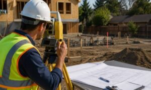
Burned Areas Create New Boundary Risks
Fire often destroys boundary evidence. Fences burn. Wood stakes disappear. Even metal monuments can shift when soil erodes or equipment moves through the site.
When this happens, boundary lines become harder to confirm without field work. A due diligence survey retraces property lines using records and on-site measurements. It also looks for signs of encroachments that may only become visible once debris is removed.
Without this step, buyers may inherit disputes they did not expect. With it, boundary questions surface early, while options still exist.
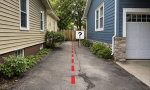
Access and Easements Can Change Overnight
Access is another common issue after wildfires. Fire trucks, cleanup crews, and heavy equipment often use temporary routes. Later, those routes may block recorded easements or damage shared roads.
On paper, access may still exist. On the ground, it may not function. A due diligence survey compares recorded access rights with actual conditions. It shows whether legal access lines up with usable access.
This matters to lenders and insurers as well. Properties without clear, working access often face delays or added requirements.
Fire Alters Drainage and Buildable Areas
Burn scars change how water moves. Without vegetation, runoff increases. Slopes erode faster. Drainage channels deepen or shift.
These changes affect buildable areas. Setbacks may shrink. Pads may need redesign. In some cases, lots that once worked for development now require extra engineering.
A due diligence survey documents current terrain. It helps teams see how fire damage affects grading, drainage, and layout. Because of that, plans adjust early instead of mid-project.
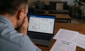
Why Skipping a Due Diligence Survey Costs More Now
In a fast-moving market, some buyers want to save time. They rely on old surveys or seller documents. After wildfires, that shortcut carries more risk than before.
Post-fire properties face higher review standards. Cities look closely at access, drainage, and safety. Lenders do the same. When survey issues appear late, projects stall. Redesigns cost money. Timelines slip.
A due diligence survey reduces those risks. It brings clarity before closing. That clarity supports smoother approvals and fewer surprises later.
When Buyers Should Order One After a Fire
Timing matters. A due diligence survey should happen early, not after plans are complete. It is especially important when:
- Buying vacant or fire-damaged land
- Planning to rebuild or expand
- Adjusting lot lines or access
- Seeking financing or investors
By ordering the survey early, buyers keep control. They can renegotiate, redesign, or walk away if needed. Once a deal closes, options narrow.
Why Local Experience Makes a Difference
Southern California presents unique challenges. Steep slopes, wildfire zones, and strict codes shape every project. A due diligence survey must reflect those realities.
Surveyors familiar with post-fire sites know what to look for. They understand how burn areas affect boundaries, access, and drainage. They also know how local agencies review survey data.
That experience helps clients move forward with confidence. It also saves time during permitting and construction.
A Practical Step in an Uncertain Landscape
Wildfires add uncertainty to land deals. They change what is visible and what is hidden. Because of that, assumptions no longer hold.
A due diligence survey provides a clear picture of the property as it stands today. It supports smart decisions, safer investments, and smoother projects. Most of all, it protects buyers from risks that only appear after the smoke clears.
In a post-fire market, due diligence is not extra. It is essential.