If you have ever contacted more than one survey company and received very different price quotes, you are not alone. Many homeowners and buyers feel confused when one licensed land surveyor charges much more or less than another. At first, this can feel frustrating. Still, there is a lot happening before a quote is ever sent.
A professional survey price is not based on guesswork. Instead, it comes from careful review, research, and experience. Every property has its own challenges. Understanding those challenges helps surveyors give a fair and accurate price.
Why Survey Pricing Is Different for Every Property
Two properties can look almost the same from the street. They may sit side by side and have similar sizes. Even so, what lies below the surface can be very different.
Some properties have clean records that clearly show where boundaries belong. Others have old or unclear documents. Some have missing markers or past changes that make boundaries harder to confirm. Because of this, a licensed land surveyor cannot rely on appearance alone. Each property needs careful review.
This is why survey prices vary. It is not random. It reflects how much work is needed to do the job right.
The Research That Happens Before the Site Visit

Long before a survey crew arrives, research begins. In many cases, this takes more time than the fieldwork.
A licensed land surveyor reviews deeds, old maps, and land records. In older areas, these records may go back many years. Some contain outdated terms or missing details. Others may even conflict with one another.
Because of this, surveyors must carefully study each document to understand the true property lines. This step helps prevent errors, disputes, and legal problems later on.
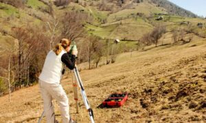
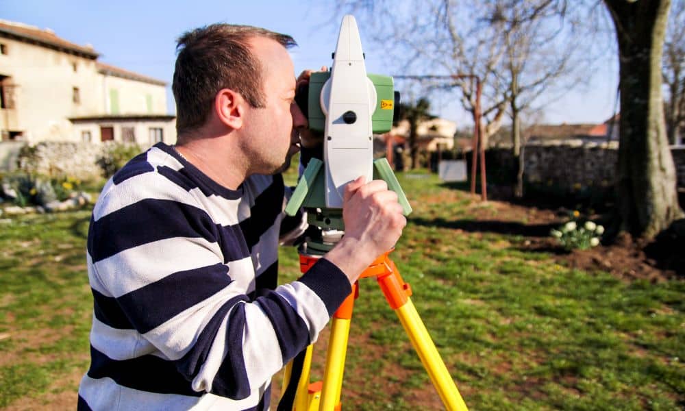
Finding Property Markers on the Ground
After research, the next step is visiting the property. Here, the licensed land surveyor searches for physical markers that show boundary corners.
These markers can include metal rods, concrete blocks, or small caps placed in the ground. Over time, many of these become buried, damaged, or removed. When markers are missing, surveyors must rebuild the boundary using old measurements and professional judgment.
This process takes skill and patience. When few markers remain, the work becomes harder. As a result, this added effort affects the final price.
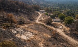
How Property Conditions Affect Survey Work
Each property presents its own physical challenges. Some are flat and open. Others have steep slopes, thick plants, or tight access.
Hills, heavy brush, fences, and walls all slow down survey work. In cities, buildings and locked gates may block access to corners. Sometimes, surveyors must return multiple times to finish the job.
Because these issues increase time and labor, they play a big role in pricing.
Why Legal Responsibility Matters So Much
Surveying involves legal responsibility. When a licensed land surveyor sets property lines, they take professional responsibility for accuracy.
If a mistake leads to a dispute or legal claim, the surveyor becomes involved. That is why surveyors carefully check for risks such as fences crossing lines, driveways overlapping boundaries, or utility lines cutting through lots.
This careful review protects property owners and helps avoid costly conflicts.
What Happens Before You Receive a Quote
Many people picture surveyors looking at a map and giving a fast price. In reality, they spend time reviewing records, studying the site, and planning the work.
A licensed land surveyor considers how long research may take, how hard fieldwork will be, and what risks could appear. They estimate time, equipment needs, and crew effort.
Only after this review can they create a fair quote.
How You Can Help Improve Quote Accuracy
Homeowners can help surveyors prepare better quotes by sharing helpful information. Clear records, photos, and access notes allow surveyors to understand the site faster.
Simple details such as property documents, past surveys, and pictures of fences help surveyors see possible challenges early. This leads to more accurate pricing and fewer surprises.
Why Paying More Can Save You Money Later
It is natural to want the lowest price. Still, cheaper surveys can create expensive problems.
A quality survey helps prevent boundary disputes, building mistakes, and permit delays. When survey work is rushed, errors happen. Fixing them later often costs far more than the original survey.
Paying for careful work now protects your property value and peace of mind.
The Value of Hiring a Licensed Professional
A licensed land surveyor completes years of training and testing. This ensures strong technical skills and legal knowledge.
When you hire a licensed professional, you gain confidence. Your survey meets legal standards and holds up in disputes. That trust matters when dealing with property.
Final Thoughts
Survey pricing can feel confusing at first. However, once you understand the work involved, the process becomes clear.
A licensed land surveyor does more than measure land. They protect ownership, reduce risk, and bring clarity. Every quote reflects research, care, and responsibility.
When done right, a professional survey becomes one of the smartest investments you can make in your property.